5/12/07 (Saturday): I just figured out how to give you a link to a satellite image of our campground. That's River Road at the top of the screen (running east/west), with the bike trail just below it. Our driveway runs north/south. Ours is the first camper on your right as you come in the driveway. Click here: Campground.
Here's another link that's zoomed out a little so you can see the road (River Rd.) and the bike path. The campground is on the bottom right of the screen and the Betsie River is south of that. Our favorite evening walk is west toward lake Michigan. That's Elberta on the bottom of Lake Betsie (south) and Frankfort above (north) of Lake Betsie. And, of course, the big water is lake Michigan. Click here: Zoom View.
Let me know if these links work and whether you like them or not.
Joyce and Wiley
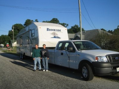
Our Home on Wheels
About Me

- Joyce and Wiley
- We took early retirement from careers as Executive Assistant (Joyce) and Lawn Care company owner (Wiley). We have been full-time RV'rs since March, 2006. We've taken our RV to Maine, Michigan, California, North Carolina and everything in between. We live in Florida in the winters and travel in the summers. It's a tough life, but someone has to live it!
2 comments:
The maps worked :) I don't think I really still don't know where the campground is though on the zoomed out map.
It's the loop road on the bottom right of the map (the only road on that side of River Road).
Post a Comment