 First I want to tell you about our visit to Chaco Canyon, New Mexico. I'm going to take the lazy way out here, and rather than tell you what I learned from the signs and on our guided tour, I'll ask you to read the history at this web site: National Park Service, Chaco Canyon Website. Now that you know some of the history, here are a small number of the pictures we took on our excellent guided tour.
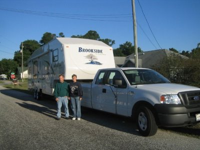
 There was a 16-mile road into the park, the last 13 miles of which were unpaved. We were so glad we'd dropped the RV off at the campground! It took us over an hour to navigate that awful, cratered, washboarded road!! I had a headache and every tooth in my mouth hurt after that road.
 This tiny "river" cut the canyon. It's almost dry right now, but apparently in some years it's got a lot of water in it. The only trees we've seen for hundreds of miles have been in little ravines that must have some water seasonally. As you can see, the trees are starting to turn.
 The canyon walls are a pleasing pink color, and the ruins blend right in.
 This is what's left of the "great house." According to our guide, theories about it's role in the Pueblo Indian's life are changing. The whole area has been "dug" by archaeologists since the late 1800's, but as technology improves, theories change. Currently (at least according to our guide), the theory is that it was a trading center and spiritual place, but few people actually lived here.
 There were some petroglyphs, and there was also some old grafitti.

 I forgot to mention -- we crossed the Continental Divide near Albuquerque! As I'm sure you already know, the Continental Divide is the line that divides the flow of water between the Pacific Ocean and Atlantic Ocean. Rain or snow that drains on the east side of the Continental Divide flows toward the Atlantic Ocean while precipitation on the west side drains and flows toward the Pacific Ocean. (However, some rivers empty into the desert and don't end up in the oceans.)
 The continental divide runs from northwestern Canada along the crest of the Rocky Mountains to New Mexico. Then, it follows the crest of Mexico's Sierra Madre Occidental. In South America, the Continental Divide lies along the Andes.
Every continent except for Antarctica has a continental divide.
As we approached Arizona, the terrain became steeper and there were fewer ranches--we're definitely in the desert now. We've seen lots of cactus and mesquite trees. We stopped for a couple of hours at a ghost town, which was very interesting. A couple from Ohio bought it a few years ago from a 1960's hippie guy, who'd actually lived there!
 Steins was built in 1849, deep in Apache territory. It was named for Maj. Enoch Steins of the U.S. Cavalry, who was killed by Apaches in 1875.
 The railroad built a watering tower and the town grew to a population of 1300. Steam engines needed to refill their water frequently, especially after long upward grades. There was also a quarry whose stone was used for building the railroad. Outlaw Black Jack Ketchum was captured and hung here.
The town died after the water source dried up and the railroad left. Most New Mexico ghost towns were mining towns, but this was a railroad town.
 The town had a school, church, two brothels and several bars, a boarding house and a number of homes. When the railroad left, they moved people in rail cars to other railroad towns. They could only take what they could carry, so there was lots of stuff left behind. The houses still had beds made up with linens, clothing hanging on the walls, pots and pans in the kitchen, and an old Sears catalog in the outhouse!
 The next blog will probably be full of pictures of the Arizona desert and cactus. But for now, like this tumbleweed, I'd best be moving on. Peace to you and yours!


3 comments:
Well, I see Major Stein's ghost standing in the doorway! Wiley, you stand there like you own the place. Neat shot.
I noticed the blue, cloudless skies in your photos. When you got to Arizona, in the shot of the steeper terrain, when I enlarge that photo, those stones look so "organized," didn't it seem so to you?
I enjoyed learning the info about the Continental Divide. I did not know all but one continent had one. I just never thought much about why we have such divides.
I enjoyed reading the info on the Chaco website; however, Joyce, looking at all your photos of dry, brown, not-so-exciting photos made me feel hot and sweaty. You said you had an excellent guide -- you'd have needed one to get through that somewhat barren mess! I'm referring to your first few photos -- that long, straight boring road, and those few petroglyphs with less-than-exciting pictures on them, for example. I think you mentioned you drove four hours to get to this place. Would you do it again?
By the way, have you run into any rain or bad weather on your trip so far? Had you heard that the day after you guys left Missouri, the very area through which you drove was hit by tornado winds? I couldn't believe it when I heard it in the news. There is definitely an angel protecting you two.
The weather has been almost perfect for our whole trip. I had not heard about the tornadoes in Missouri, but we are following the news about the wildfires in Southern California. We're going to call the park and make sure it's safe for us to come.
We did drive about 4 hours to see Chaco Canyon, and I would do it again because it wasn't like anything I've ever seen before. It's part of our heritage. But it would have been a lot more pleasant if not for that really bad dirt road!
Please don't give a test. I would never pass. To much going into my personal computer. At 71 I only have so much room and I'm getting over loaded. Papa and I are enjoying keeping up with you and Wiley. Happy Trails
Post a Comment